- Daily & Weekly newsletters
- Buy & download The Bulletin
- Comment on our articles
Related articles
Recent


Popular


Where is my bus? New map shows every Stib service in real-time
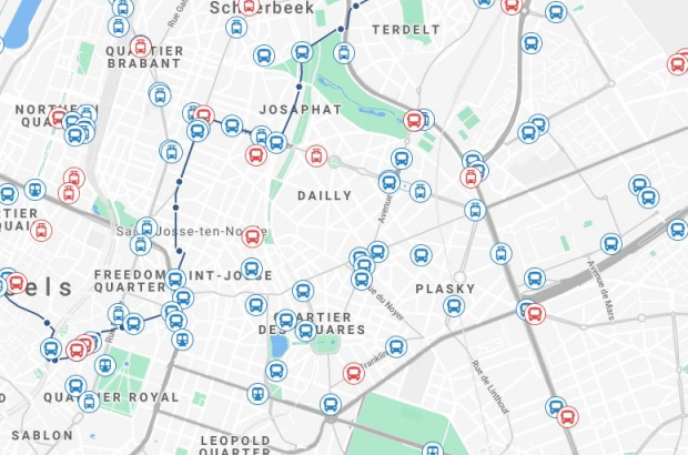
If you've always wanted to see every Brussels metro, tram and bus, moving around a map of the city in real time, here it is.
Inspired by flight-tracking services such as Flightradar24, the Liège start-up Connect2move has made a similar real-time map of the capital's public transport.
The Brusselstransit map shows services running on time in blue. Late-running services are in red - and at the time of writing, about a quarter of all Stib services were running behind schedule.
"The data from the public transport operator is open source," said Connect2move business developer Mathieu Jaspard. "The Stib does not give us the exact position of each vehicle - but by knowing the theoretical timetable and each vehicle's delay, we can plot it to within a few hundred metres."
The map's makers hope that Brusselstransit will soon be able to integrate real-time information from the SNCB, TEC and De Lijn as well.