- Daily & Weekly newsletters
- Buy & download The Bulletin
- Comment on our articles
Related articles
Recent


Popular


Get your blood pumping on countryside walks this winter
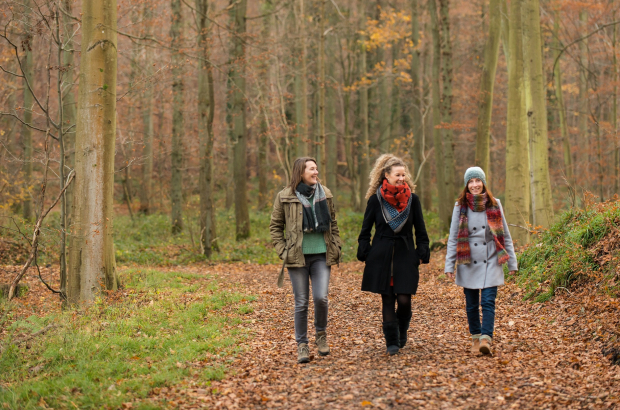
I’m the first to admit that I’m a little boring when it comes to fitness. Outside of yoga, my best effort is long walks in the countryside.
While I can’t say that I’m breathing that hard (unless I’ve taken on a hill), I am getting some fresh air and lovely views. As a city dweller, I find it incredibly important to occasionally escape a daily life made up of a constant buzz of traffic and more cement than trees.
My biggest challenge has always been finding walks that do not require me to follow a walking map, which I find are often vague and/or inaccurate. While Flanders has an impressive number of marked walking trails, finding them has always been a source of consternation.
Mystery signposts
Here’s the thing: Sometimes when I was out on a hard-sought walk, I would see these wooden signposts pop up with numbers and arrows and little walking figures. This suggested a walk, but what did it all mean?
I was clearly missing something, so I went on a google hunt. And I stumbled across Wandelknooppunt.be. Poof! My walking life changed in an instant.
“More than 12,000 km walking pleasure!” the site boasts. OK, it says it in Dutch, but if that’s still a language that eludes you, I’m happy to report that the site is user-friendly even for the less Dutch-literate among us. Once you get the hang of it, you’ll fly through planning your walk quite quickly.
Flemish Brabant’s tourist office actually explains the system in English, including suggested walks. Since it’s also the province that surrounds Brussels, it’s a great place to get started if you live in the capital.
The Brussels/Flemish Brabant border is interesting, in fact, because of its stark contrast. You very quickly move from extreme urban to extreme pastoral. So many parts of the province are incredibly picturesque, and they’re right on Brussels’ back stoop.

Back to the Wandelknooppunt website: The first thing you’ll see is a big map with several numbers on it signifying walking regions. Hover over them to see the name of the region.
Then pick an area in which you’d like to walk. Let’s say Pajottenland, to the west of Brussels, number 14.
Clicking on this brings up a network of criss-crossing paths. Hone in and you’ll see that every junction where two or more paths come together has a number. Those are the numbers you see on the wooden signposts out in the real world.
From here, you create your own walk by clicking on a number, then on another and another, circling back to your first number. The system tells you with every click how many kilometres you’re up to. Then you just write down the numbers or save your walk in the system and pull it back up on your mobile when you get there.
Never get lost again
There are two really beautiful things about this system. First: You can start wherever you want and design your walk to loop back. Second: Each signposts points you in the direction of the next one, so it’s a foolproof system, even for someone like me who is, shall we say, prone to disorientation.
Right click the numbered node to get the address, then set your GPS. Since these are rural areas, it’s pretty easy to find somewhere to park (for free) near the start.
If you want to take the train or a bus, just find a number that begins near a train station or bus stop. Flemish Brabant is peppered with train stations; there are 16 alone in Pajottenland, for instance.
Flemish Brabant also produces a whole walking booklet, flagging up 24 of its most beautiful walks. Previously only published in Dutch, the next edition will also be published in English, French and German.
Or take to your bike: There is also a Fietsknooppunt system to plan cycle routes.
Sign up for Flemish Brabant's newsletter in English for more inspiration on walks and places to visit
Photo top ©Bert Dekelver, photo centre ©Lander Loeckx